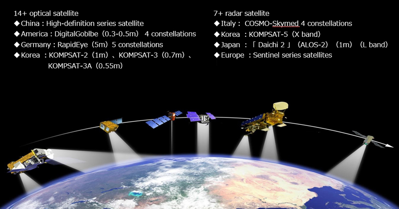
InSAR (Interferometric Synthetic Aperture Radar) is a technique for mapping ground deformation using radar images of the Earth's surface that are collected from orbiting satellites. Unlike visible or infrared light, radar waves penetrate most weather clouds and are equally effective in darkness. So with InSAR it is possible to track ground deformation even in bad weather and at night-two big advantages during a volcanic crisis. Two radar images of the same area that were collected at different times from similar vantage points in space can be compared against each other. Any movement of the ground surface toward or away from the satellite can be measured and portrayed as a "picture" - not of the surface itself but of how much the surface moved (deformed) during the time between images. Imagery is provided by space agencies in Italy, Germany, Canada, Japan, Korea, Europe, and the U.S.

To create this radar deformation "picture" a pulse of radar energy is emitted from a satellite, scattered by the Earth's surface, and recorded back at the satellite with two types of information: amplitude and phase. The amplitude is the strength of the return signal, influenced by the physical properties of the surface. The round trip distance from the satellite to the ground and back again is measured in units of the radar wavelength, and changes in that distance between the time two radar images were collected show up as a phase difference. Combining these two images is called "interfering" because combining two waves causes them to either reinforce or cancel one another. InSAR greatly extends the ability of scientists to monitor volcanoes because, unlike other techniques that rely on measurements at a few points, InSAR produces a map of ground deformation that covers a very large spatial area with centimeter-scale accuracy. This technique is especially useful at remote, difficult-to access volcanoes and at locations where hazardous conditions prevent or limit ground-based volcano monitoring.
We use satellites to measure surface motions anywhere around the world. This technique is called InSAR. Our deformation data is fundamentally changing the way our customers look at their assets. We help people manage their maintenance for the long term and we help prevent environmental disasters. Radar satellites started recording surface movements in 1992. Since then the number of satellites and the resolution of the images have increased significantly. We can built a data archive that covers 70% of the earth’s land. We use that archive to provide insights in the historical movements of infrastructure. We aims to apply the InSAR technique to roads, railways, bridges, buildings, electric power, pipelines, dike and dam stability problems. We will change our focus and move away from being an InSAR service company towards being a data driven company, actively developing products that help asset managers apply our data to their deformation related problems.
For Site Selection Determine existing surface motion during site selection processes. Support the design and the optimisation of the ground instrumentation network. We provides unique support in reconstructing past ground motion patterns, which could potentially affect constructions. Using a historical archive of satellite imagery, We can identify unstable areas prior to construction and reconstruct their displacement to assist in the planning of new sites. Monitoring with satellite data minimises survey time and cost compared to traditional measurement techniques.
For Development By mapping the evolution of ground displacement during construction, engineers can better understand the relationship between activities and the onset of any related settlement. We offers thousands of measurement points over large areas, at a fraction of the cost of traditional monitoring. It also increases displacement information beyond excavation surroundings, to determine the extent of any deformation occurring within a wider area.
For Maintenance Assess the stability of assets over time to monitor that deformation remains within design parameters. Control impact on assets of deformation occurring in adjacent areas. Regular monitoring of post-construction displacement can identify structural weaknesses. Identifying motion that could indicate a structural weakness helps engineers to determine if actions should be taken. Moreover, InSAR Monitoring provides deformation maps to assess areas at risk.
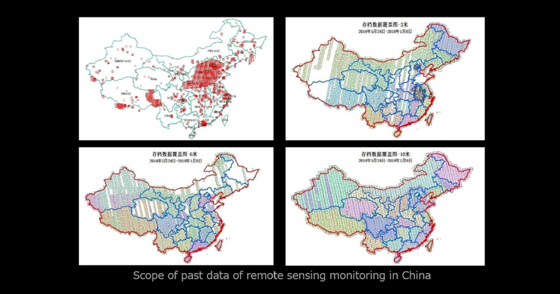
An urban health database has been established that has accumulated radar satellite data for over 7 to 10 years (including a high precision database of over 400 cities in China).
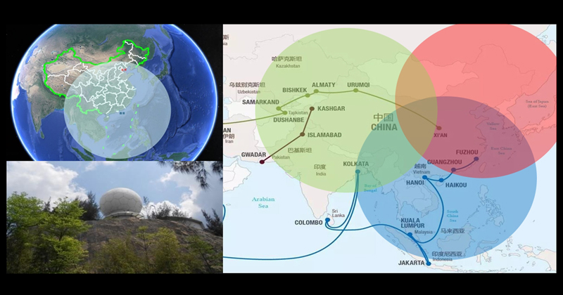
We have successfully established and operated ground remote sensing satellite ground receiving stations, and have built and operated multiple remote sensing satellite ground receiving stations.
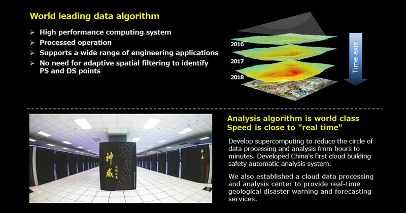
We use the PSP-InSAR algorithm (one of the world's top algorithms for radar satellite data processing).
InSAR Technology Expressway Deformation Measurement Provides surface stability analysis along highways

Analysis of high risk deformation areas

Expressway tunnel entrance-collapse analysis

Landslide risk analysis along high-speed railways
To be the top InSAR service provider in Asia Pacific as this region is one of the most active crust and the GDP (Japan, Korea, China, Taiwan, India, Indonesia etc.) » Search for new InSAR fields (finance / economy, insurance, real estate, retail, entertainment, tourism, logistics, etc.) Conventional fields (agriculture, forestry and fisheries, disaster prevention, security, architecture, civil engineering, infrastructure, urban development, environment, climate change, weather, ocean, energy, resources and mining, etc.) » Aiming at foreign markets (such as developing countries and SDGs markets) In Japan, abundant terrestrial data can be obtained. And can be used effectively in developing countries with large land areas with little ground data. » Utilization of new technology → Improve accuracy and grasp new information Image recognition by deep learning → Diversification of identification targets and improvement of accuracy Combination with ground based big data → Correct data for deep learning, extraction of new correlation Launch of new observation system